8 best tourist navigators


One may live in the city as much as necessary, but do not get rid of the desire to climb where no man’s foot has ever walked. And not necessarily a leg - cycling does not lose popularity, quadrocyclists and owners of enduro consider “trips to the pampas” to be mandatory. A good navigator will definitely become a reliable travel assistant, allowing you to quickly make a route, determine your coordinates and record a track to show off your accomplishments among like-minded people. Hunters and fishermen will not refuse the similar help.
Tourist navigators are seriously different from automotive and structurally, and programmatically. The first talk is about the possibility of autonomous work: the navigator must remain operational for many days, without the possibility of obtaining external power or recharging. Therefore, archaic replaceable batteries are still used in them - on the long road you can replace them by taking stock. Dust and moisture protection required: in the campaign is anything. And the most important thing - on the maps there should be not only roads, but also “directions”.
What to choose in 2018? The best navigators for all types of tourism are in our today's ranking.
| Category | A place | Name | Rating | Price |
|---|---|---|---|---|
| The best universal navigators for hunting, fishing and tourism | 1 | Garmin Montana 680 | 9.8 / 10 | 46 690 |
| 2 | Garmin GPSMAP 64ST | 9.6 / 10 | 26 090 | |
| 3 | Garmin eTrex 20x | 9.0 / 10 | 13 500 | |
| The best wrist tourist navigators | 1 | Garmin Foretrex 701 | 9.7 / 10 | 46 265 |
| The best navigators for offroad raids | 1 | Garmin GPSMAP 276Cx | 9.9 / 10 | 50 890 |
| The best navigators for mototourism | 1 | Garmin Zumo 595 | 9.7 / 10 | 76 280 |
| 2 | AVEL DRC050G | 8.9 / 10 | 9 900 | |
| The best navigators for cycling | 1 | Garmin Edge 1030 | 9.7 / 10 | 51 240 |
The best universal navigators for hunting, fishing and tourism
|
46 690
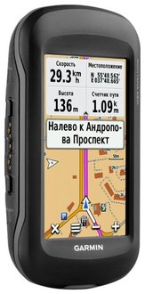
The American company in this market continues to be a de facto monopolist: the very name Garmin for tourist navigators has become, in fact, a synonym. The compact navigator, conveniently lying in the hand, has a traditionally small display: its diagonal is only 4 inches. But, unlike many common models, the pixel density is higher here - the display resolution has been brought to 272x480, and it is quite informative. Management - touch, and allowing not to remove gloves during the work. As for power, the navigator is as versatile as possible: it has a built-in battery designed for 16 hours of operation, there is a compartment for AA batteries, and in addition, it can be powered from USB or directly from 12 volts in the car bracket. So leave Montana 680 without power will need to try. Navigation (supporting both GPS and GLONASS) works great, even without a connected external antenna, and the level of detail of topographic maps deserves a special thanks — even the type of forests is indicated on them. Not forgotten, and the ability to download "paper" maps: Custom Maps technology allows you to load into memory a raster scan of the desired map, linking it to GPS coordinates. In addition, when buying a navigator, a yearly subscription to the BirdsEye service is given, which looks like a hybrid mode familiar to Yandex navigation. Of course, the navigator has a sufficient degree of protection - the case conforms to the IPX7 standard, so it’s not terrible to drop an expensive device into the water. Plastic itself is a quality soft-touch. An additional feature is the presence of a good 8-megapixel autofocus camera, which allows you to take pictures without straying from the routing, and attach them to the coordinates. Main advantages:
Minuses:
|
 9.8 / 10
Rating
Reviews
The best navigator for any use, the maps are accurate, and automatic recording of tracks allows you to go anywhere. Battery for LDPE enough with a margin. |
|
26 090
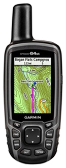
So, if you want to buy a truly high-quality tourist navigator, you will inevitably have to choose between Garmin and Garmin. The GPSMAP 64st model is “sharpened” primarily for hiking: a rubberized body sits comfortably in any hand, allowing you to safely drown and drop the navigator. There is no risk to damage the expensive sensor - control is push-button. The screen itself is small - a diagonal of 2.6 inches, but it is well readable in any light. There are all the branded "chips" Garmin - this is loading your own maps, and working with the BirdsEye service. It is possible to connect external sensors via ANT +, provided for pairing with smartphones via Bluetooth. The GPS / GLONASS module with excellent sensitivity and a quick cold start is only 25 seconds responsible for working with satellites. Even if you manage to get to where none of the satellite groupings will be available, the high-precision built-in compass with tilt compensation will continue to work, and the barometer and altimeter (they distinguish the 64st from the usual sixty-fourth) allow the navigator to work as a portable weather station , predicting a change in the weather - it definitely won't hurt hunters and fishermen. There is also the possibility of connecting an external antenna. Main advantages:
Minuses:
|
 9.6 / 10
Rating
Reviews
"Garmin" is "Garmin" - an excellent navigator, accurate, reliable, with which it is not terrible to climb into the taiga on a categorical campaign. |
|
13 500
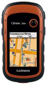
And you can somehow cheaper? It is possible, but it will still be Garmin. eTrex 20x is an upgraded version of the already well-known, but already removed from the release of the "twenty" with an improved screen and increased memory capacity, assembled in a compact, secure case. If you already had the opportunity to get acquainted with the previous models of the eTrex series, then you will understand the new model instantly. In addition to the pre-installed topographic map of Russia, the navigator allows you to use TOPO 24K maps, “Roads of Russia”, BlueChart g2 is available for sea walks, and City Navigator NT is useful on highways. And, of course, the navigator supports the Custom Maps mode (download of its raster maps) and the BirdsView subscription. In other words, in terms of functionality and reception quality, the GPS / GLONASS eTrex 20x satellites are in no way inferior to the more expensive Garmin navigators. Then what is the dog buried in? First, on the screen - although it has become better than the predecessor model, it is still small (2.2 inches, resolution 240x320). Secondly, the processor is slower here, which is noticeable with a quick scrolling of the card. But the autonomy is not bad - up to 25 hours on one set of AA batteries! Main advantages:
Minuses:
|
 9.0 / 10
Rating
Reviews
Navigator on the hunt does not interfere absolutely, but it will always help out. You can not carry constantly on, starts very quickly. |
The best wrist tourist navigators
|
46 265
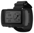
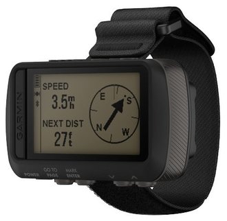
This navigator does not try to pretend to be a smart watch - it is deliberately brutal, and not at all for sight. Foretrex not only meets the requirements of the MIL-STD-810G standard: its screen can be read through night-vision devices, and the accurate ballistic lovers will appreciate the built-in ballistic calculator (!). To track the coordinates, three satellite systems are used at once - not only the usual GPS and GLONASS, but also Galileo. The autonomy for such compact dimensions is great - up to 48 hours in navigation mode, up to a week in UltraTrac mode (recording tracks with extended coordinate determination intervals). And it is on two AAA batteries! So Foretrex 701 will be interesting not only for those who are looking for a practical and reliable navigator of this format, but also for lovers of expensive gadgets with a military inclination. Well, why not? Main advantages:
Minuses:
|
 9.7 / 10
Rating
Reviews
Fashionable gadget for extremal? Yes, I would say that. I drag both in campaigns, and on an airsoft, and with a parachute jumped. Is that a diving opportunity left to add. |
The best navigators for offroad raids
|
50 890
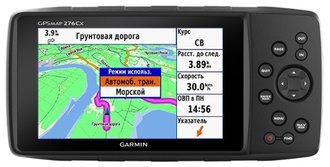
Garmin's top navigator will be the best choice for off-road raids if budget allows. However, carrying a Panasonic Toughbook with an external GPS receiver will cost even more, so everything is relative. Even outwardly, the navigator resembles an SUV - angular, deliberately simple. Lovers of "licked" gadgets waiting for a hard attack of cognitive dissonance - as a device in such a rough case with terrible inconsistencies of the back cover can cost so much. However, when you are in the dirt to the ears, there is no place for glamor. Complaints about the "brakes" in comparison with smartphones are no less stupid, you can just as well complain that expensive protected laptops do not pull GTA 5. The screen at the navigator is five-inch, covered with shock-resistant glass. No sensors - only harsh keys. Again, all in favor of "off-road" to save the opportunity to work with the navigator with dirty hands or gloves. Also note dirty. The power supply system is triple: if you remove the back cover, you will first find a 4400 mAh lithium-ion battery underneath it (up to 16 hours of operation), followed by a battery compartment. In addition, the navigator can work from external power supply - via USB and from 12 V (contact pad for car mounting). The reception quality is superb, even on the built-in antenna - you can evaluate it yourself by getting into some kind of military "abandonment" for the concrete floors of the Cold War times. The “two hundred seventy sixth” functionality allows you to compare it with the specialized ERTF navigator systems used in world-class rally competitions. It is not for nothing that this Garmin navigator is used, for example, by the KAMAZ-Master team on their support vehicles in Africa Eco Race raids. Well, continue to complain about the ugly look or price? Main advantages:
Minuses:
|
 9.9 / 10
Rating
Reviews
The technique is not for everyone - just go nature and you can with a much simpler model. But for serious raids definitely have. |
The best navigators for mototourism
|
76 280
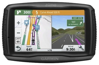
As befits "Garmina", the navigator is not cheap, but worth the money. High-quality five-inch display is readable under the direct rays of the sun, and its sensor can be used without removing the motor-gloves. Tired of asphalt roads? Use the Garmin Adventurous Routing feature to get directions on local primers that aren't found on regular car maps. Want to keep a travel video from memory? Use the pairing with the camera Garmin VIRB to record videos on the flash drive navigator. Housing - dust and water tight, with side trimming.He calmly experiences falling, shaking and raining, besides it can be removed from the motorcycle and walk on foot. Fortunately, the external battery pack allows you to leave for a long time. However, it is impossible not to clarify - the navigator is designed for mototourism in the sense that it is invested in this concept by Americans and Europeans. That is, in the right region there must be at least some roads, while according to the possibilities of orientation in the “full offroad” Zumo 595 is inferior to wearable tourist navigators. Main advantages:
Minuses:
|
 9.7 / 10
Rating
|
|
9 900
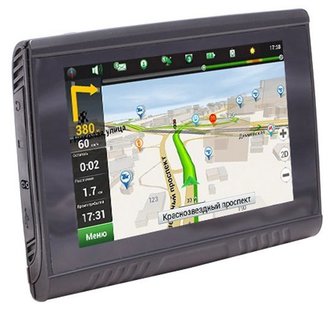
Long live exceptions! - let's say we finally include in the ranking of the best tourist navigators not Garmin. Chinese AVEL (also known as Avis), of course, is in many respects inferior to eminent “Americans”, but it is relatively inexpensive. At the same time, he has enough dust and moisture protection for mounting on a motorcycle or quad bike, if you do not hit a special extreme. The navigator receives power from the on-board network through the bracket, and when removed, automatically switches to the built-in battery. The five-inch screen is bright enough and can be used with gloves. “Interior” here is a classic for Chinese navigators - MSTAR MSB2531 processor, 128 MB “RAM”, operating system - Windows CE. Navitel and iGo are pre-installed, you can download your software for working with topographic maps. Main advantages:
Minuses:
|
 8.9 / 10
Rating
Reviews
Riding with him on a quadric, quite a good thing for the money. The screen reads fine, does not slow down too much. |
The best navigators for cycling
|
51 240
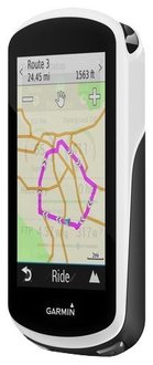
Having started the ranking of the best tourist navigators with Garmin, we’ll finish it: specialized models for cyclists in the Russian market are offered only by this company. Equipped with a 3.5-inch color screen, it resembles a tourist model, but it also has a lot of “chips” especially for cyclists. For laying “two-wheeled” routes, you can work with Trendline, which works according to data downloaded by other cyclists, and during group travel you can connect all the navigators of the group: for example, you can send a message to lagging comrades that you have stopped and are waiting for them at a specific point . Navigator is compatible with Varia's “smart” bicycle headlights and can automatically send alerts to selected contacts in the event of an accident; it allows you to connect pulse and pedal sensors for cyclists. It is possible to predict weather changes. And if you miss the oncoming rain, then you should not be afraid - the case is protected according to the IPX7 standard. The power source is a built-in lithium-ion battery, which lasts for 20 hours. Few? Add the external battery pack offered by Garmin in the accessories catalog. Main advantages:
Minuses:
|
 9.7 / 10
Rating
Reviews
I really liked it. Then you and navigation (really high-quality), and bike computer, and a bunch of functions until the counting of calories burned. |
Which tourist navigator to choose?
Tourists, hunters and fishermen have not so many choices, if we talk about firms, and you probably already understood this from the rating: specialized models, with which it is not scary under the rain in the taiga and the heat in the desert, only Garmin offers. Therefore, when choosing (apart from, of course, the budget), consider the main thing:
- Power type: for example, if you mostly go on “weekend trips”, then the built-in battery will be better than replacement batteries - you don’t have to change them all the time. At the worst, on the way, a power bank might help out. But in a long hike, replaceable batteries will definitely not be superfluous, especially in winter, when a frozen lithium ionnik “sucks” quickly.
- Supported systems: in the northern latitudes, GLONASS support will make it possible to plot the route more precisely, and the search for satellites will take less time.
- Screen: for “tourists” it is small, so you have to navigate by a small and rather schematic piece of the map. On the other hand, a small display has less power consumption, and the navigator itself becomes smaller and lighter: on a long hike, every gram will be counted.
- Control type: The sensor, of course, is more modern, but it will require taking away the already limited usable screen area for virtual “buttons”, it will make the navigator more expensive. Push-button control can be used in the rain and in the cold without fear for false alarms and “brakes”. And most importantly - without a sensor, the screen is corny more reliable.
Have a good shopping!
